Started the day by finishing preparations for the trip, making sure I got a hefty breakfast, shaving and going through the pack checklist one last time.
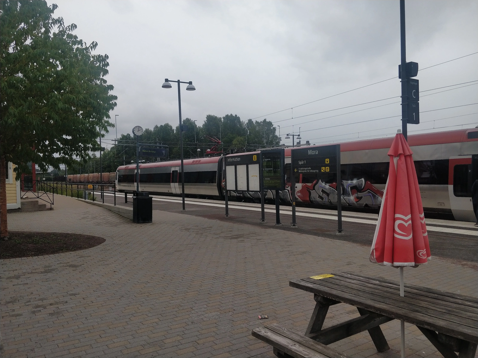
Met Andrew at the central station and got onto the first train going all the way to Gävle.
Started chatting about random philosophical ramblings about the time the conductor showed up, when we got swiftly kicked out of the 4 person booth by the preferences of the old lady across from us, who was clearly affected by the Corona-panic ("we would also prefer if they moved...")
Started to mockingly say "Geruff mah property" sort of stuff and the conductor, visibly affected, told us we could still sit together, in an empty row nearby.
Found out about the Harvard Classics from Andrew - an anthology of world literature that "could provide elements of liberal education by spending 15 minutes a day reading from it."
Found out about a paper that shows (by evaluating loose bounds for certain terms in the Drake equation) the probability that we're all living in a computer simulation is not as high as previously thought. Encouraging.
While talking about it, pulled some references from Neal Stephenson's Anathem acknowledgments page
For an exceptionally beautiful account of mathematical physics with particular reference to action principles, read ^^David Oliver's The Shaggy Steed of Physics^^
A thousand plateaus: https://en.m.wikipedia.org/wiki/A_Thousand_Plateaus
It seems Platonic Realism is a standpoint widely preferred by mathematicians as it would explain the source of axiomatic knowledge through the human mind's perception of entities that are the subject of mathematics, and which exist independently of regular human perceptions, definitions and constructions
Once in Gävle, found out with stupefaction that our next train got canceled and we're supposed to take a bus to Sandviken and then get on a train to Borlänge from there. However, the bus was kinda late and the arrival time of this train was after the 3rd train would leave...
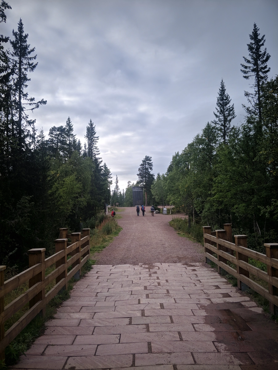
Not going to bore you with any more public transportation details, but we ended up in an SJ-provided taxi from Falun all the way to Mora, where we had some kebabs and got onto the bus to Särna, then another minibus to the entrance of the reservation, close to the Njupeskär waterfall
Actually this one little detail was pretty funny: one of the bus stations was named Kuntmatt
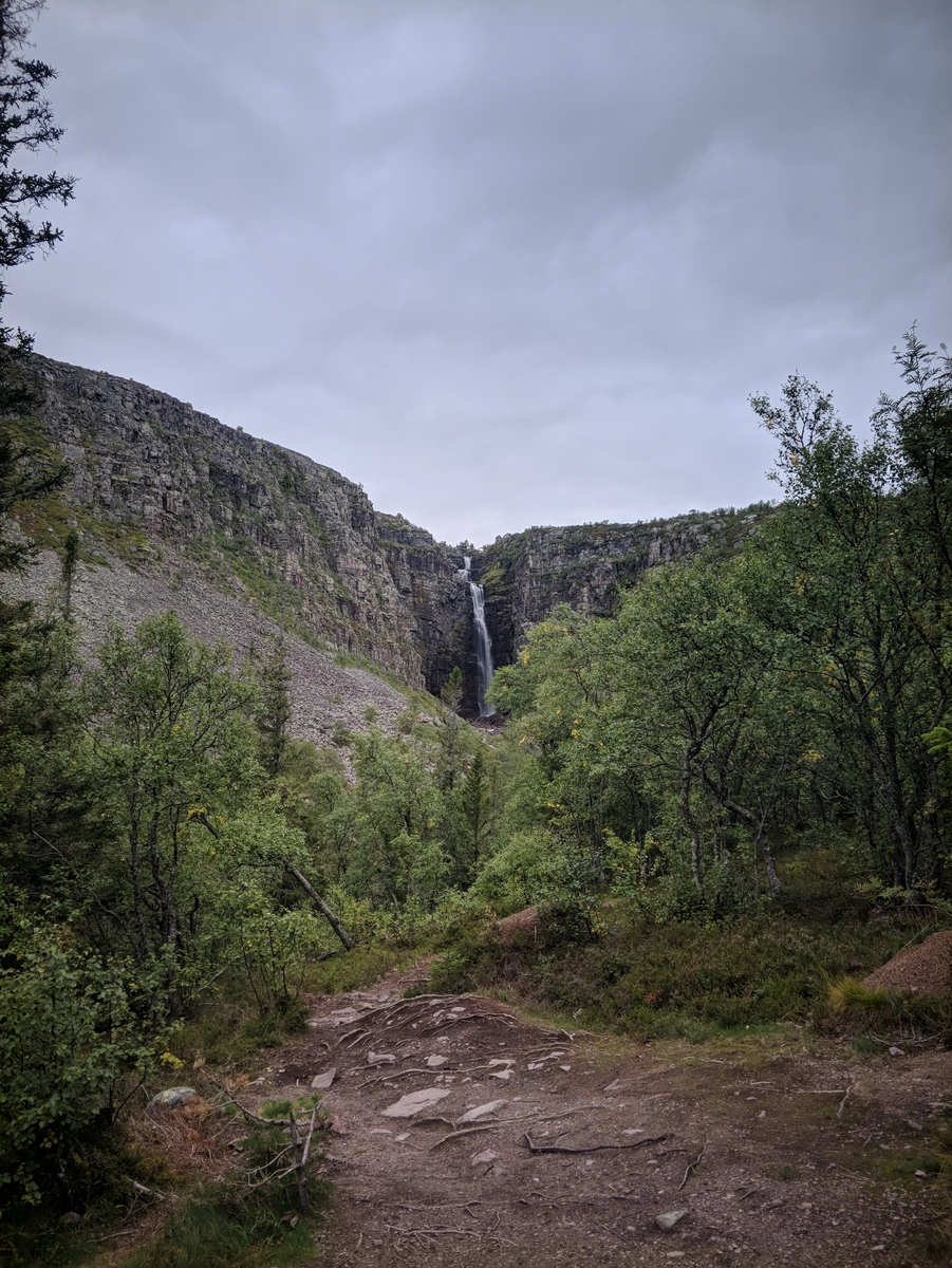
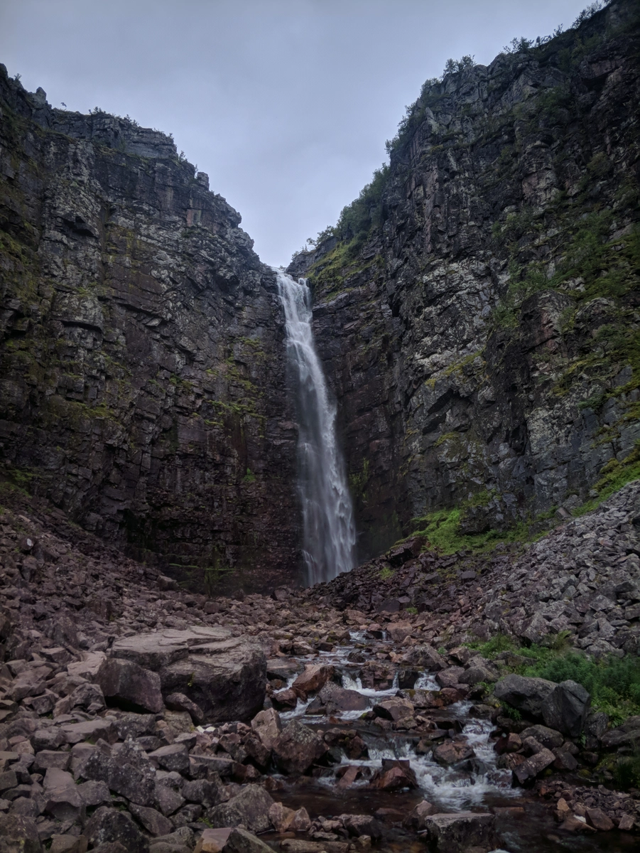
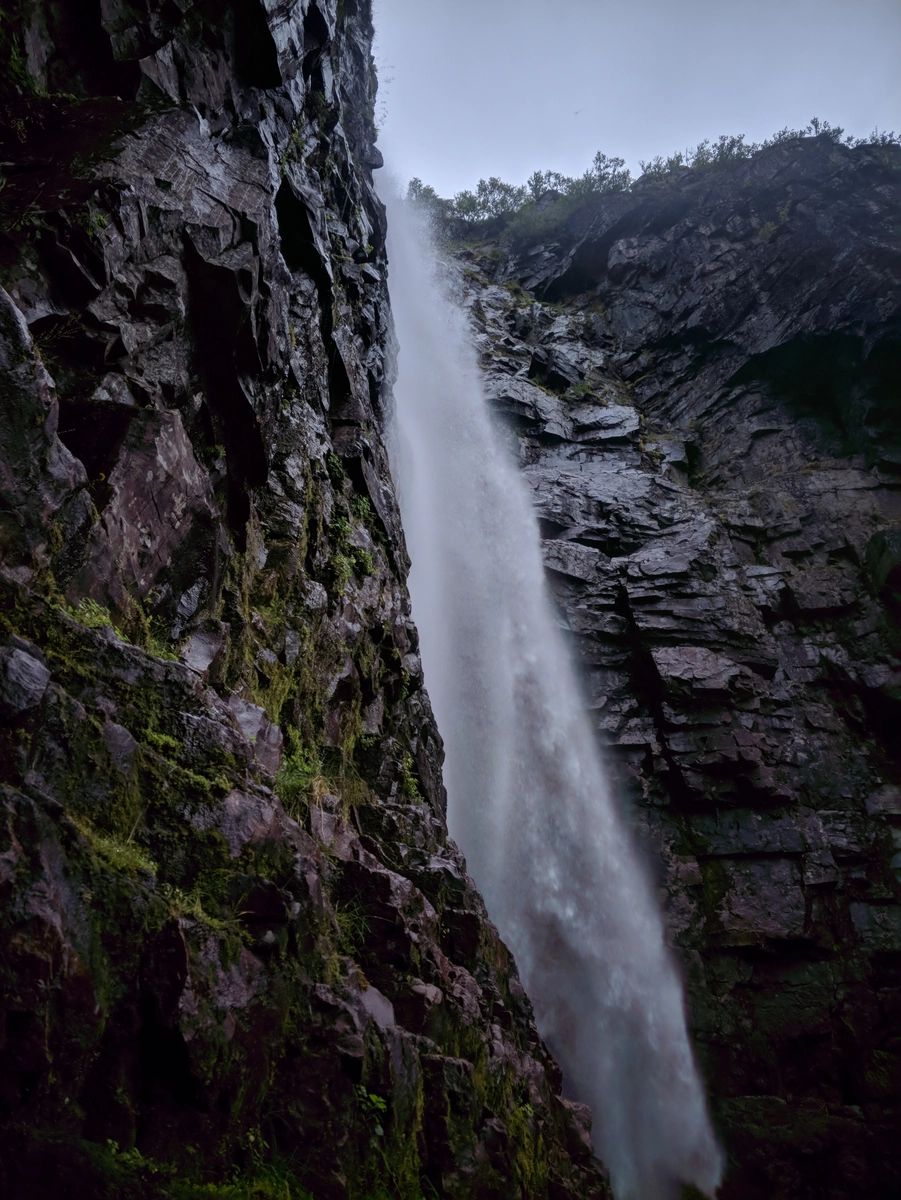
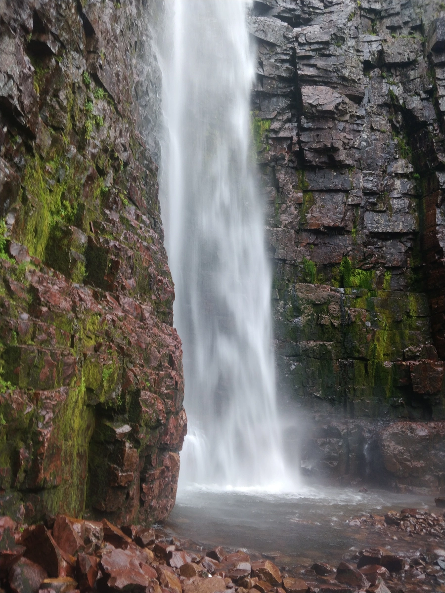
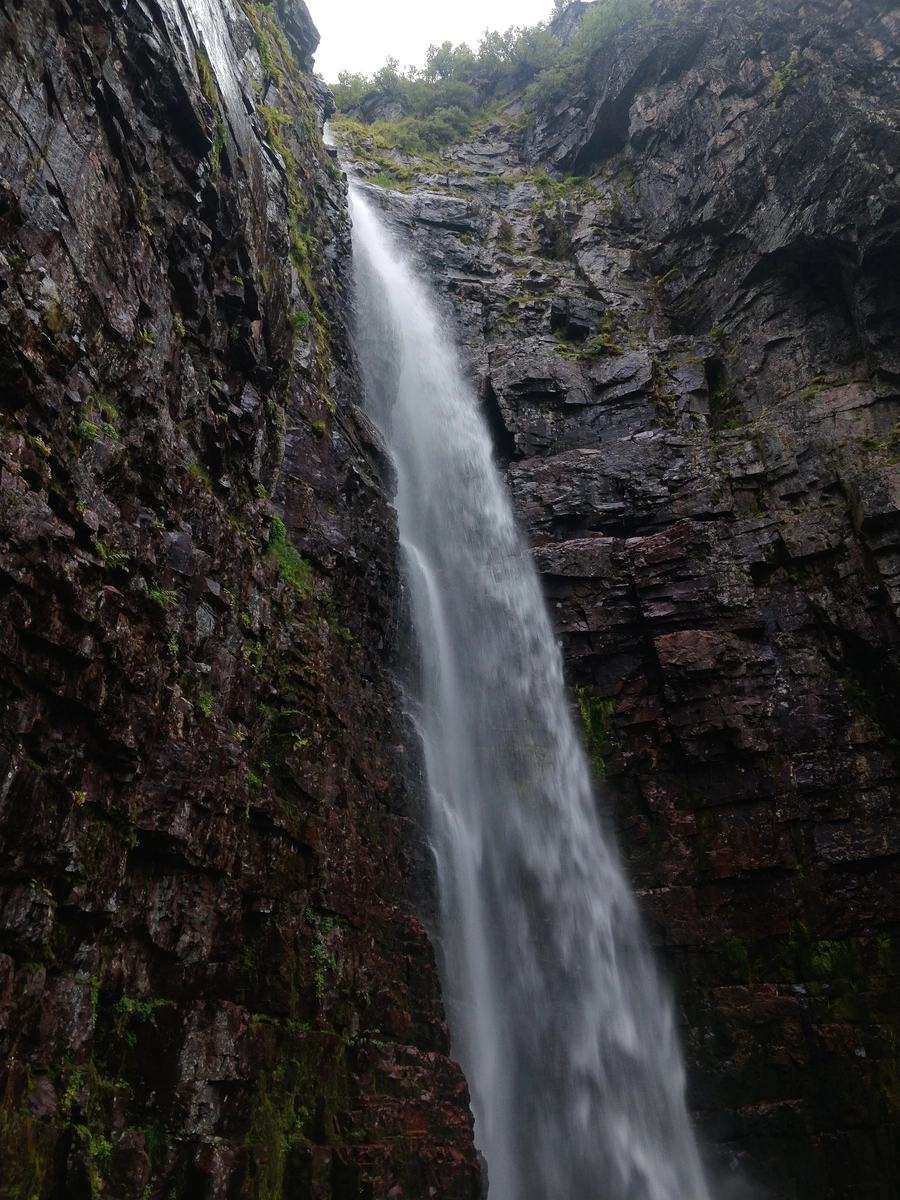
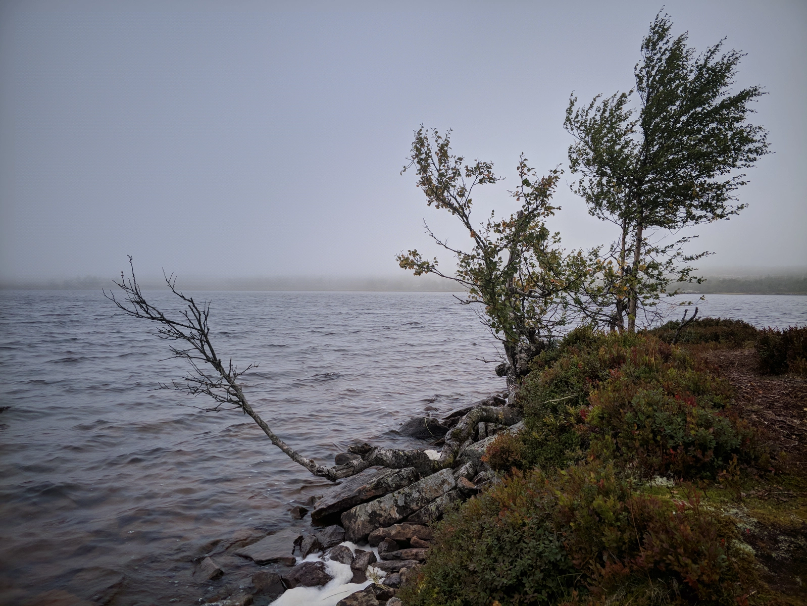
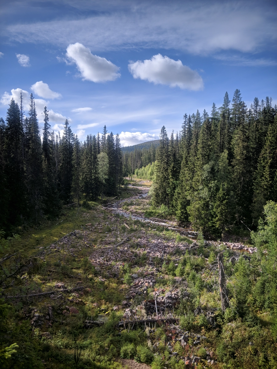
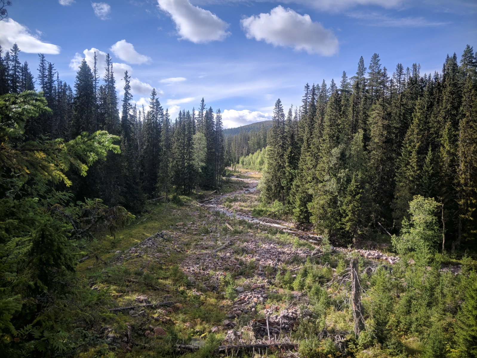
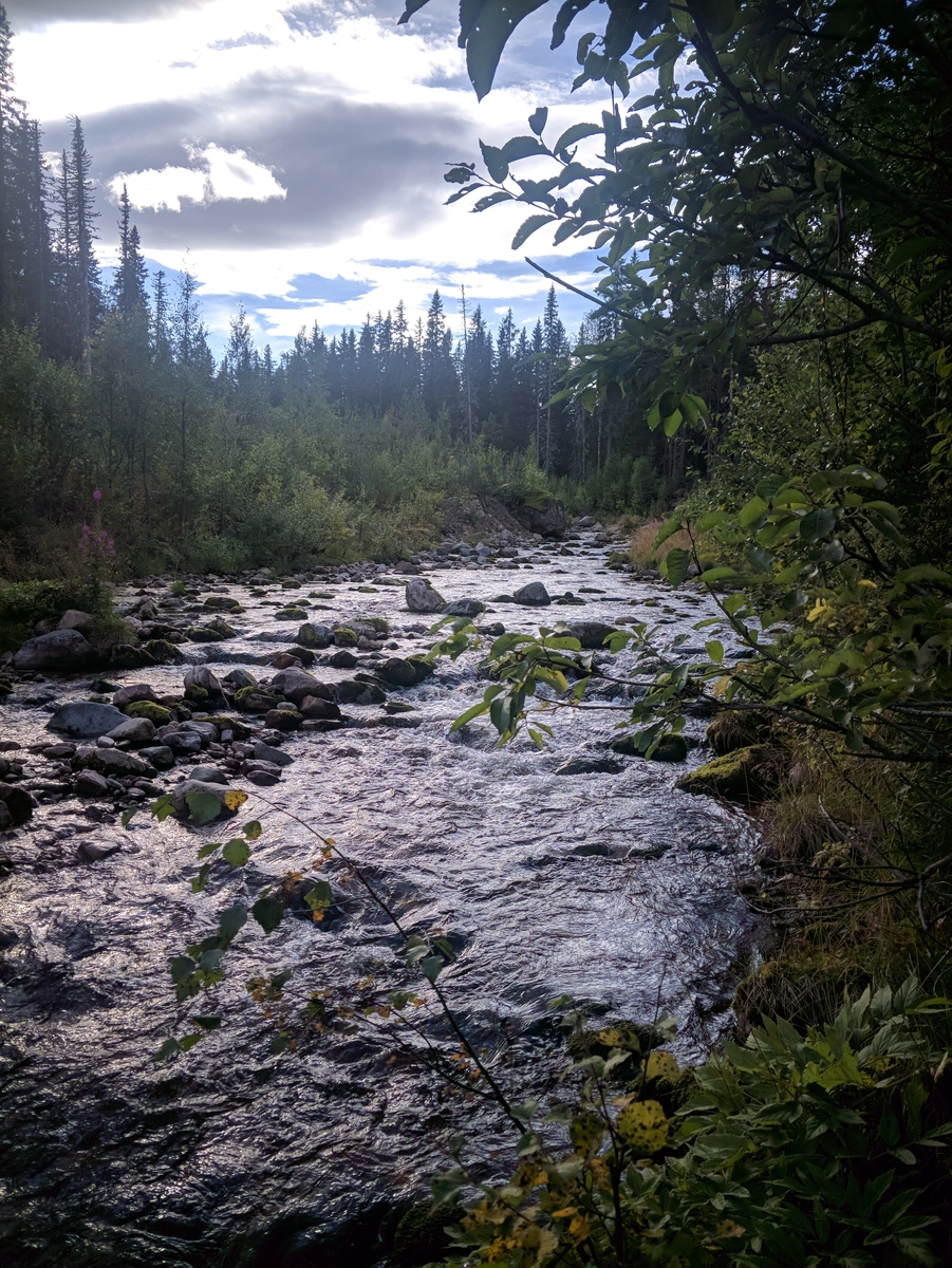
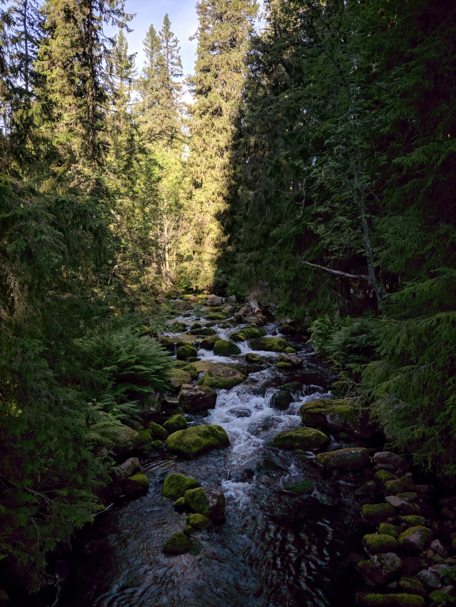
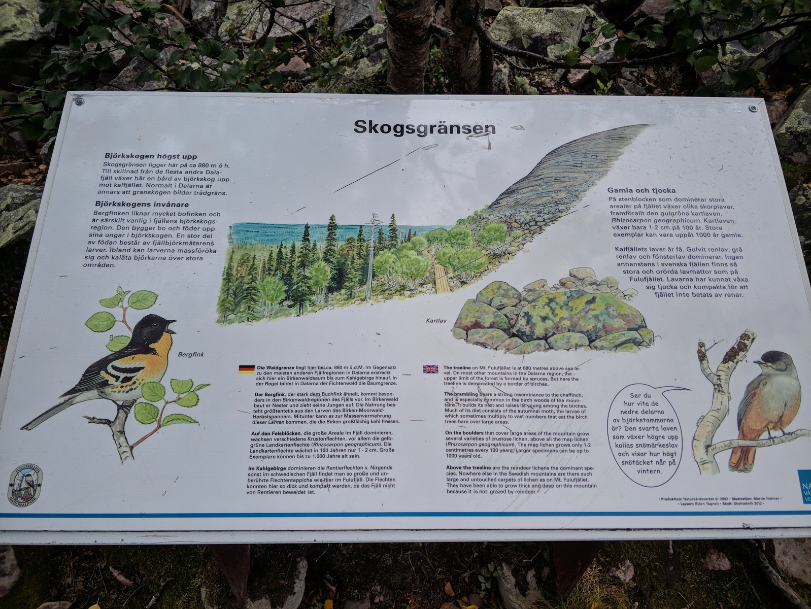
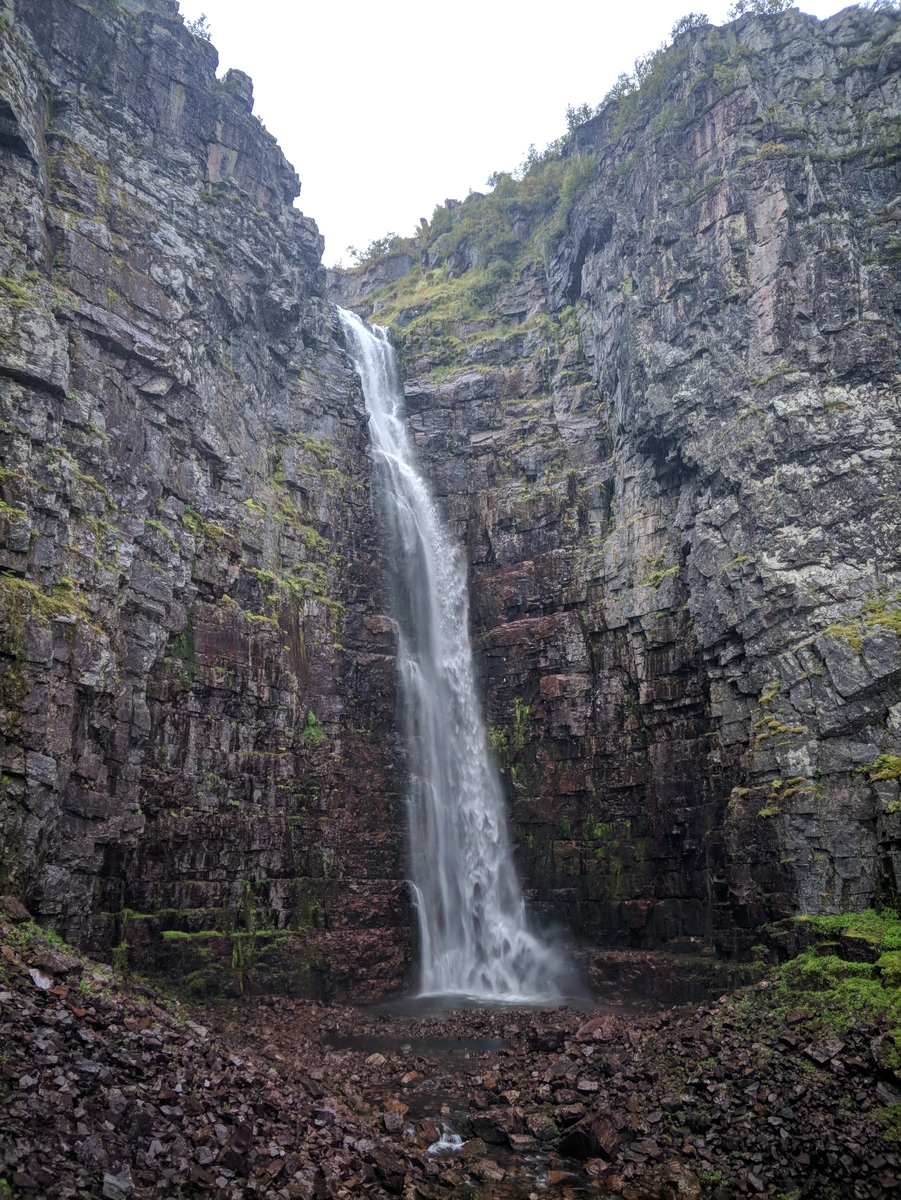
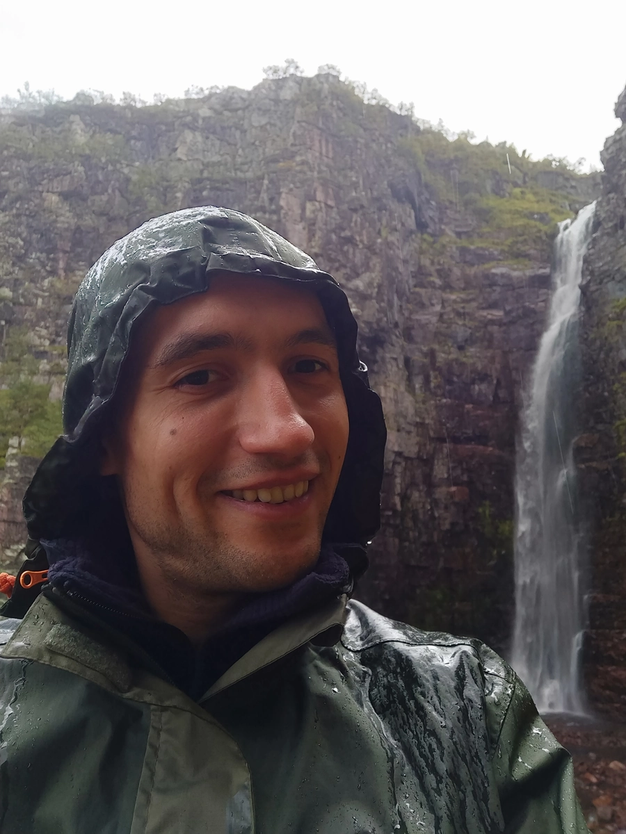
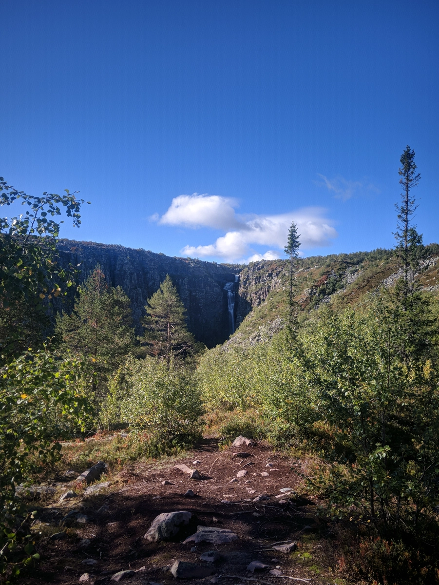
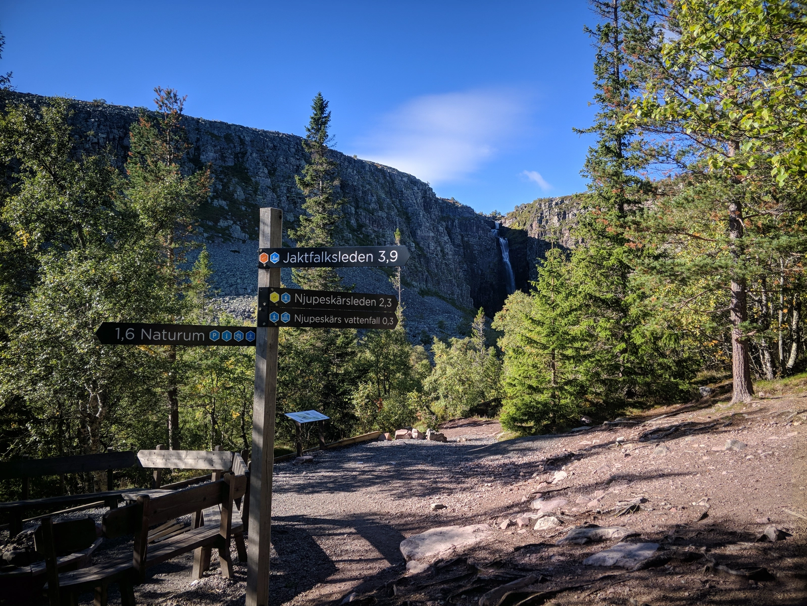
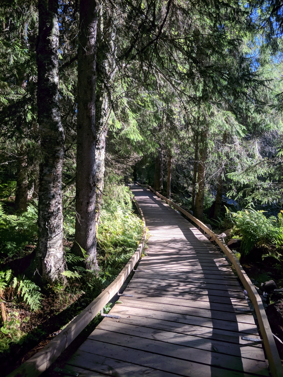
From there we finally started our trek by first visiting said waterfall. We first took a curiosity-led detour through down to the left bank of the river, only to realize that the entire way was actually arranged and "paved" through with wooden planks to improve accessibility. In any case, the waterfall was spectacular, and a good idea to put on the rain jacked before heading in as it got really really damp near it, after scrambling on the rocks a bit.
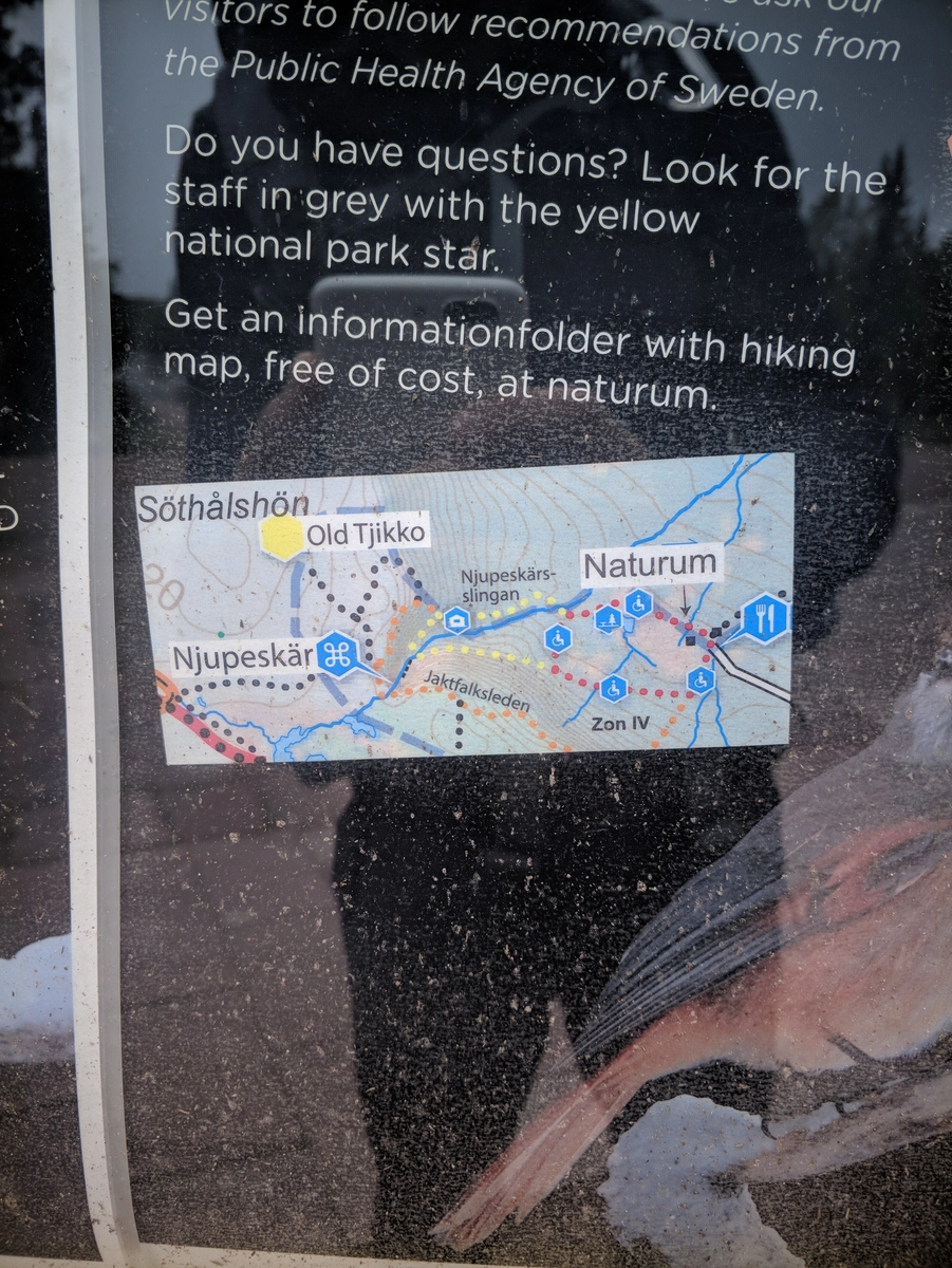
The next objective was Old Tjikko. To reach it, we tried to interpret the map which said we should retrace our steps from the waterfall for a bit, then scale up the mountain face to the North.
Ended up taking a very steep vertical there, not knowing that by retracing all the way back to the cabins we would find a much gentler way up the massif, circling it around the East.
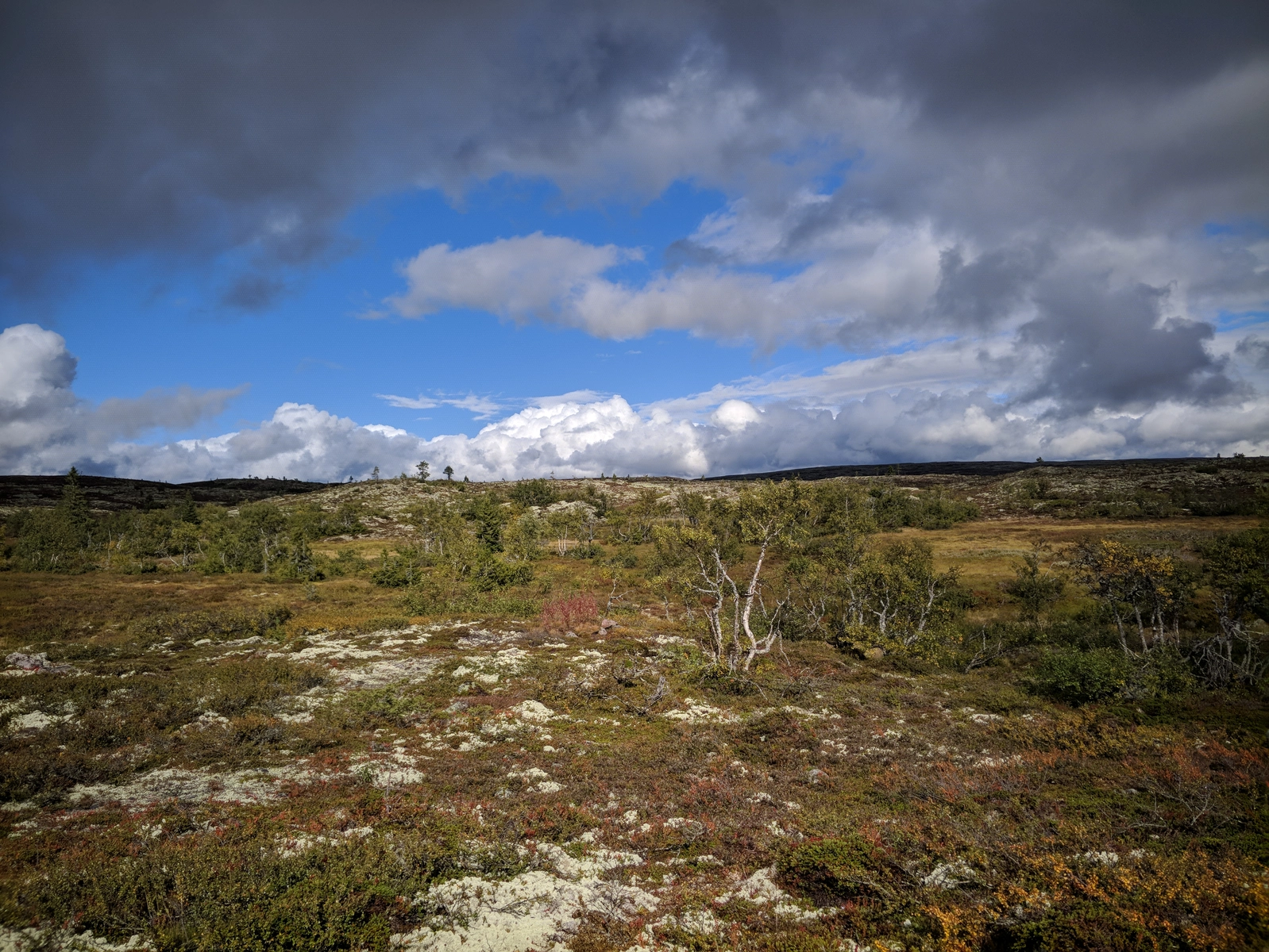
Spent some time up on the plateau trying to "sherlock" the tree's location from online photos, scrambled about for a while and couldn't find it.
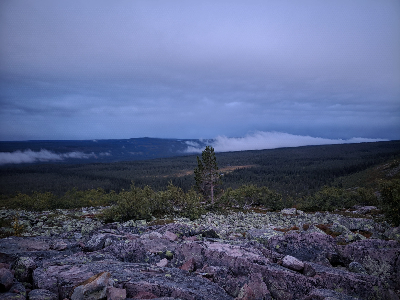
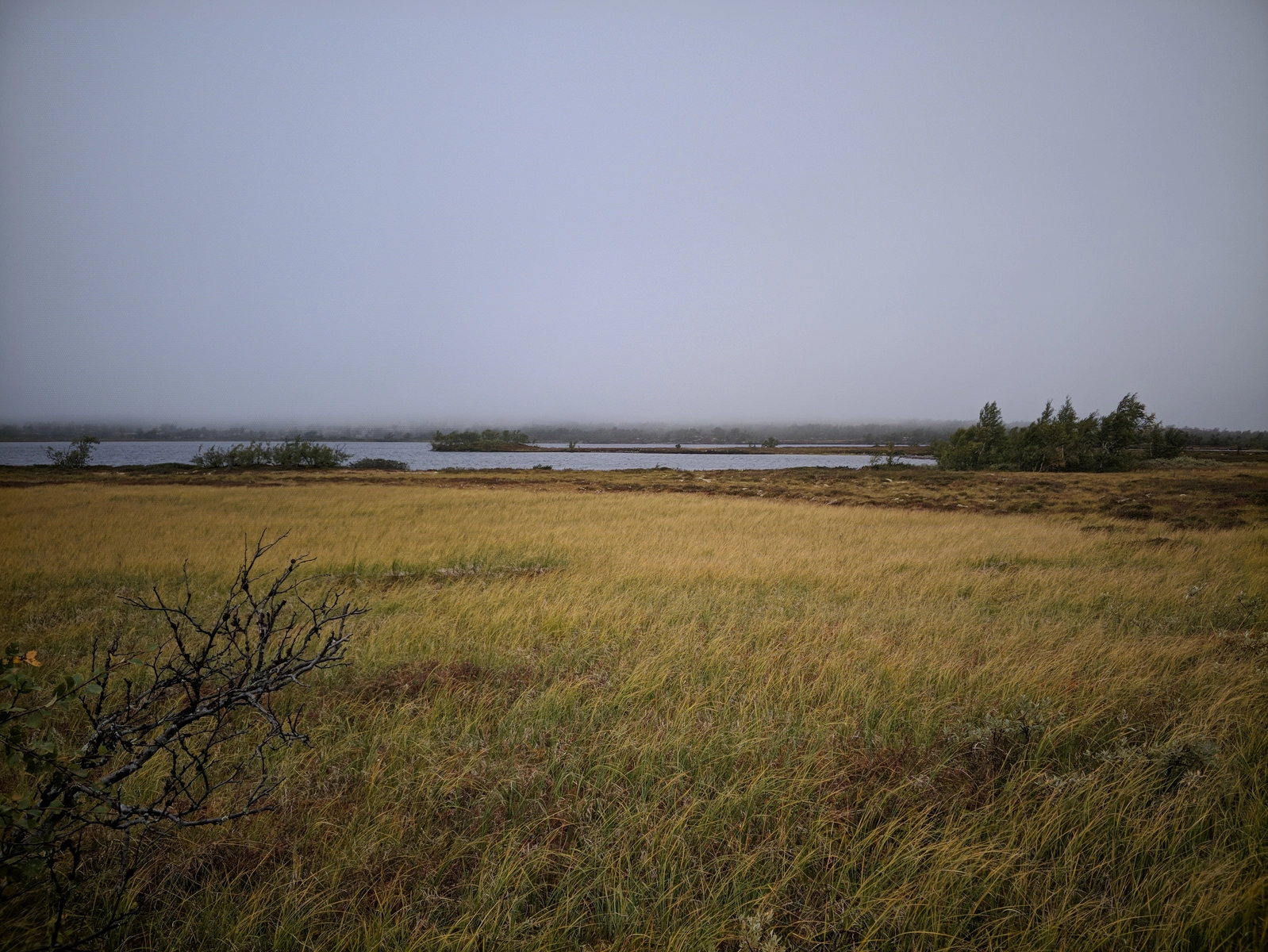
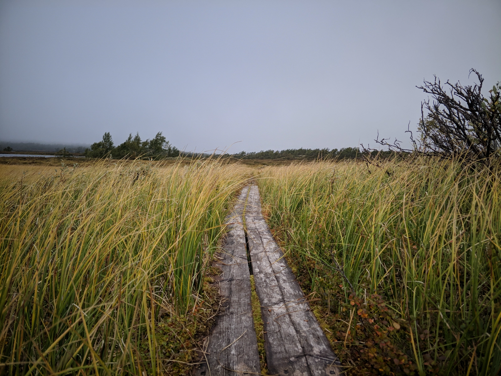
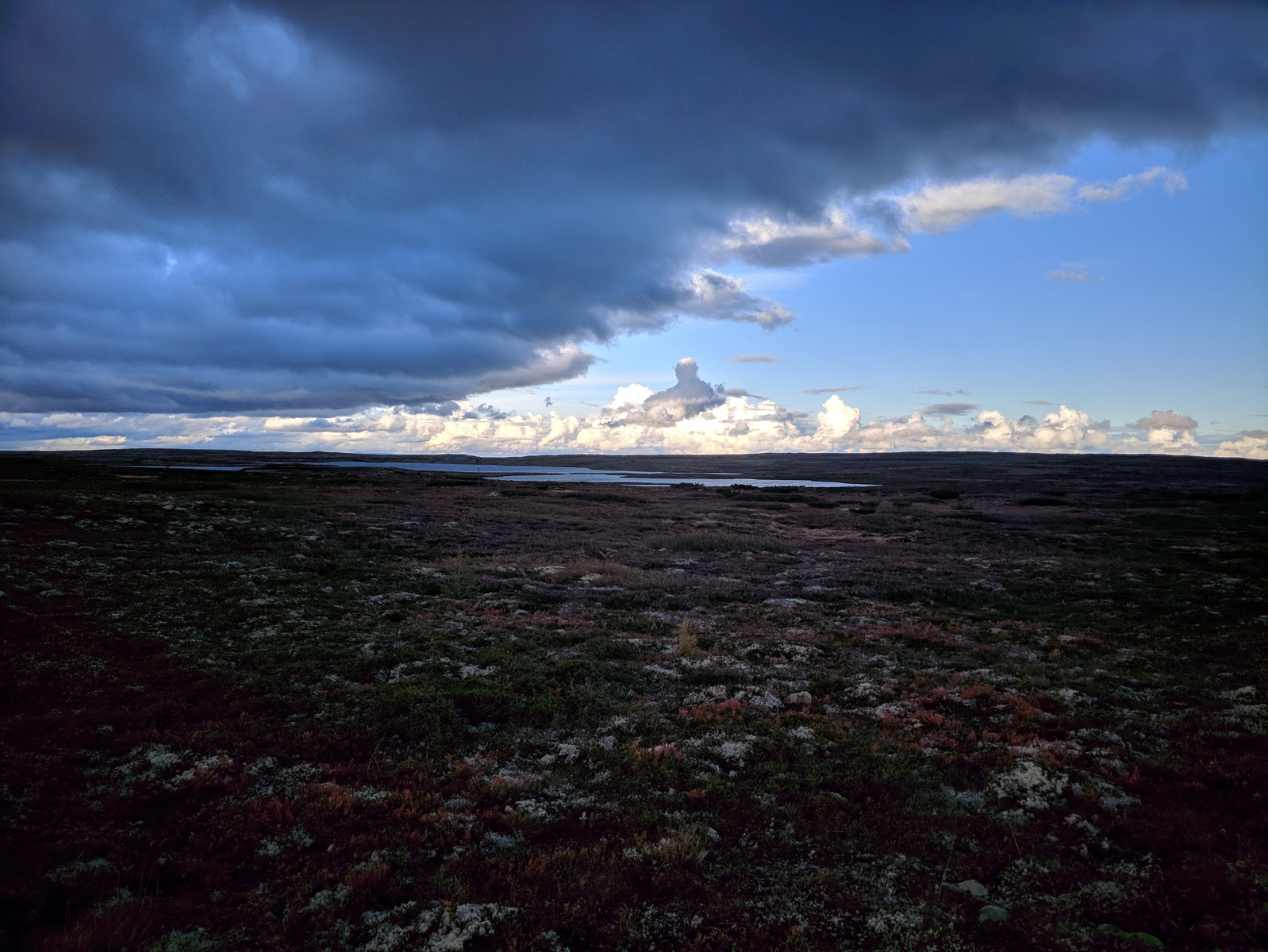
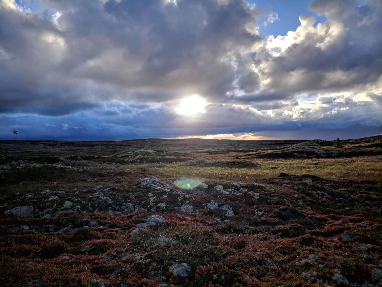
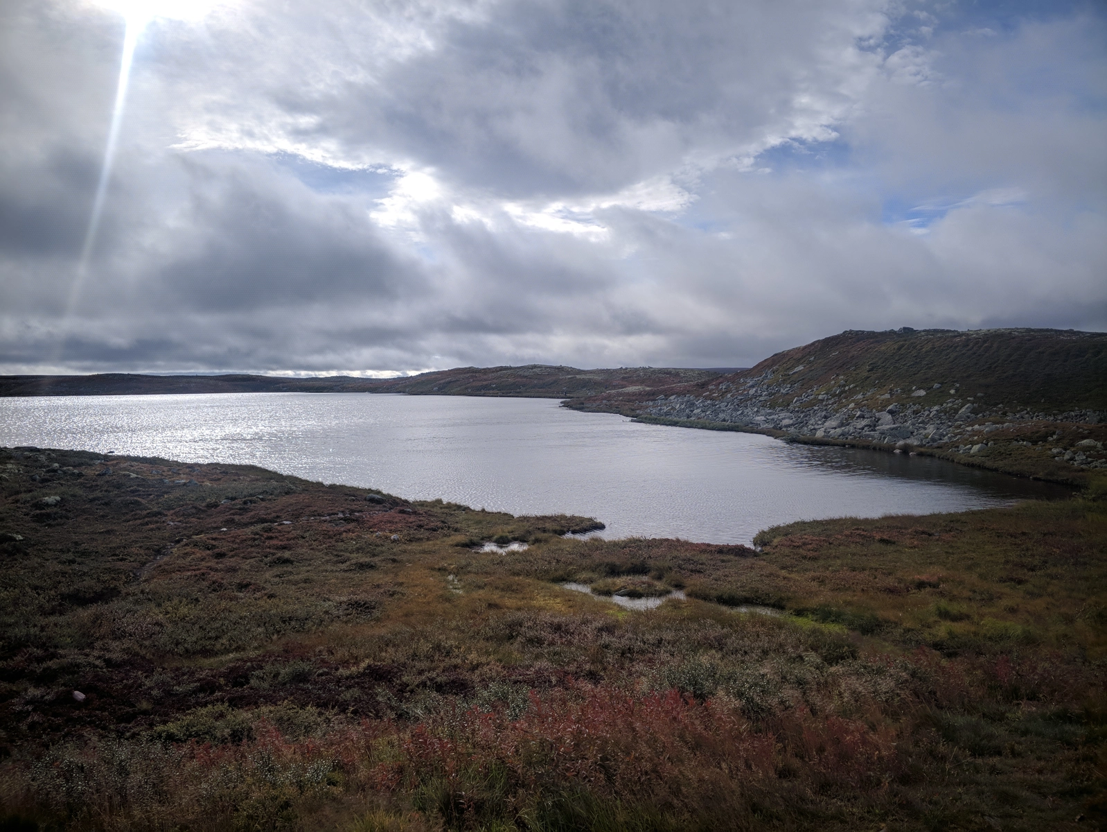
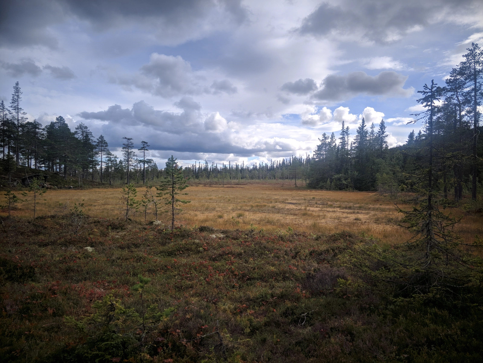
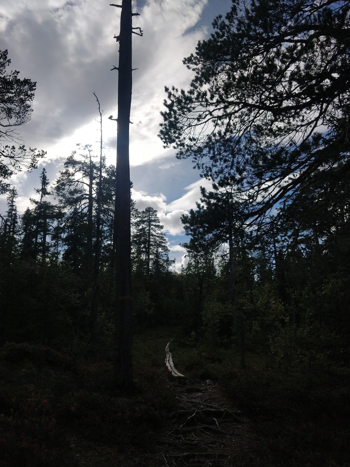
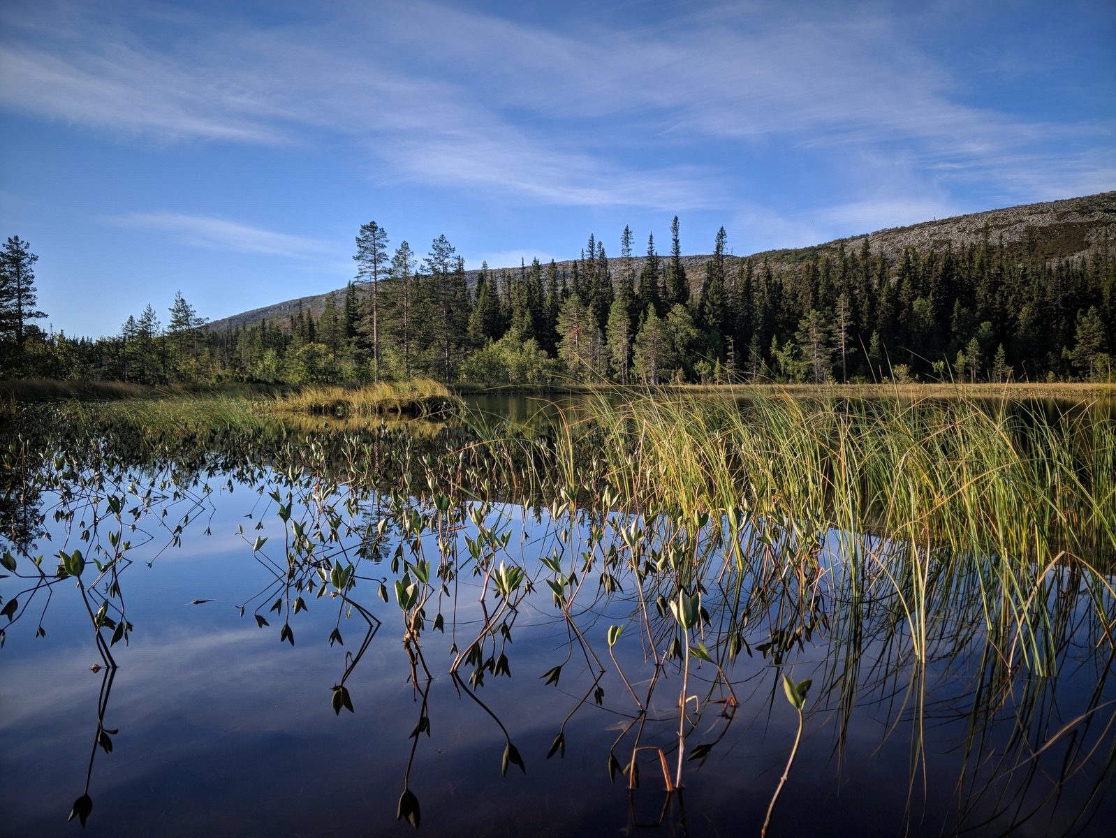
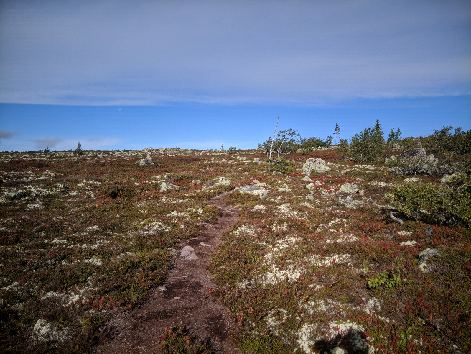
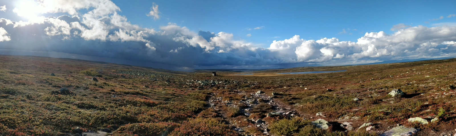
It was getting dark so we decided to push East along along the Southern shore of lake Stora Getsjön and find a camping spot.
After passing a few marshy areas, while it was getting almost dark, we found an old fireplace surrounded by relatively flat land where we set up camp.
Slept poorly, probably due to Full Moon Madness, ate the usual oatmeal breakfast, then gathered the camp.
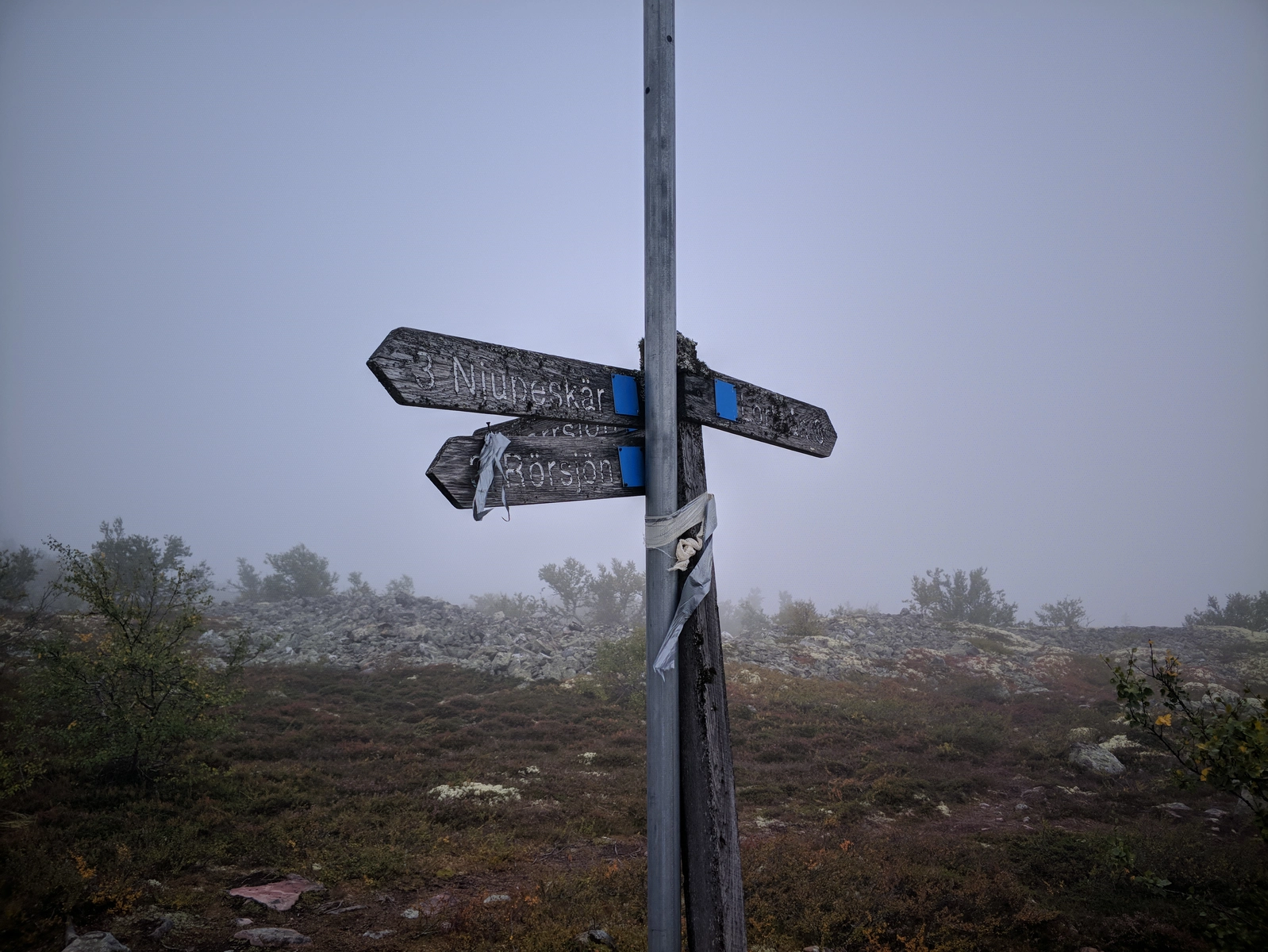
Decided to keep heading west along the lake trail, then swing around lake Getsjön through Lorthån and take the trail down south at a trail intersection.
However, I perceived it as a waste of time given that I wanted to head back to the waterfall zone and maybe look for the tree again. I therefore decided to skip across the land off-trail directly to the south towards the intersection point.
Reached it much faster than on the trail, but then decided to drop the bag and go for a short wander to the West anyway to reunite with Andrew, who I met on the shore of lake Skarphån while I was exploring a very cool looking peninsula. It had two fireplaces on it as well - pretty cool spot!
From that point I turned back East to recover the backpack, find the Southern trail and push on for lunch at the Hartsjöstugan.
All cabins were empty when we arrived, but someone had forced the lock on the main cabin so the door took a little fiddling to open. Once in, we found it very cozy, perfect spot to cook the MRE lunch and chill for a bit. While we were chilling we met with the same group of Uppsala students who accompanied us on the bus ride and reservation entrance.
The next stop was Särnmanskojan, a good 15-18 km away, continuing to the South, then turning East around the Harrsjöhön "massif". Once there we stopped for a break and I gave my feet a long-awaited breather. Some dude only wearing a down jacket and no gear passed us.
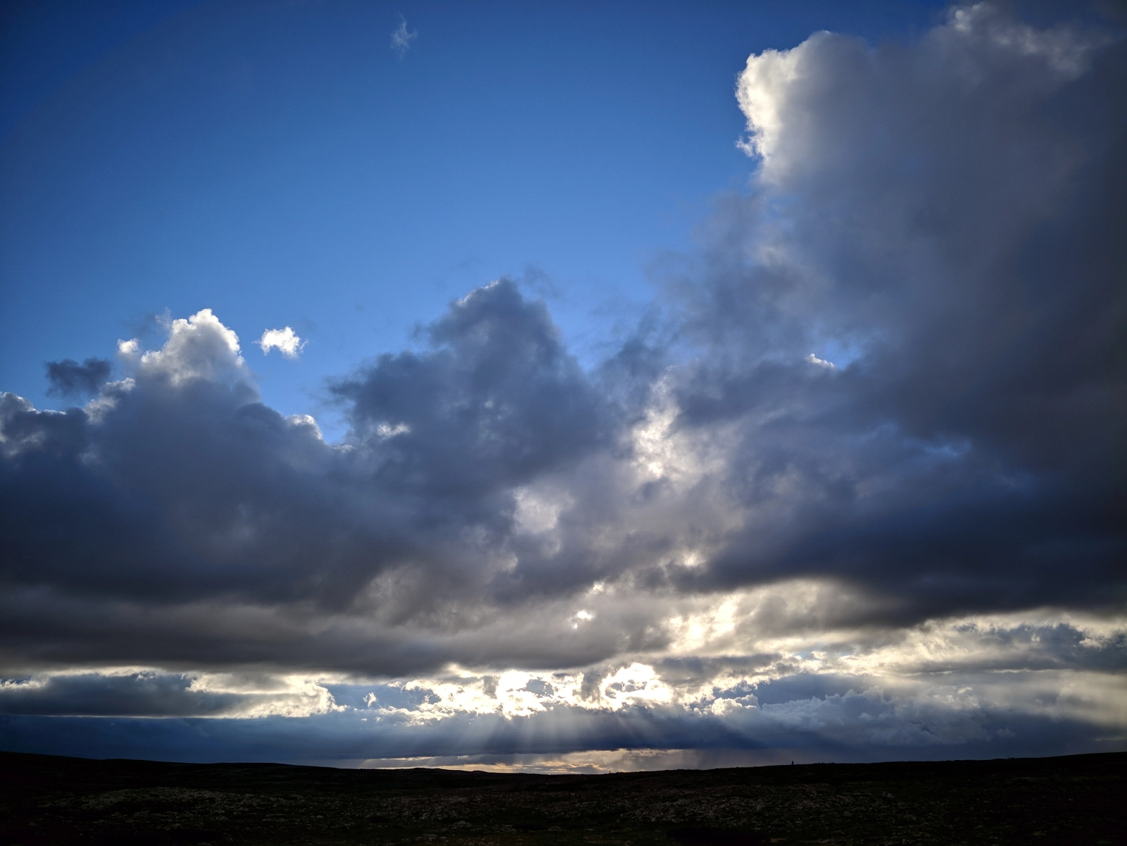
It was pretty nice to just lay in the Sun for a while, but then the sky started looking more and more dramatic, with some pretty loaded clouds from Norway menacingly approaching.
Our final destination was Tangsjöstugan and we reached it just before sunset, deciding to stop in the big cabin for dinner first, and then go and set up camp on any flat land around.
Little did we know what was about to unfold...
The big mistake here was not changing into full rain gear before leaving the cabin, because not more than 100 m away it started raining cats & dogs.
We still hadn't found a flat enough space to lay down two tents, so we set out to look for one, in the rain and with a bit of panic bubbling up.
Andrew found a decent spot a hill away from the lake and we panic-deployed the tents during the heaviest downpour to date, learning a few lessons in the process.
Managed to get the pants and the gloves extremely wet in the process and for the remaining of the evening hunkered down and listened to the storm mercilessly batter the tent.
It's always such an exquisite feeling: on one side you're super-delighted to be sheltered from the outside madness, on the other side you can't stop thinking that perhaps the entire tent will get blown down (and then what?). But I always lean more towards the former, so storms actually make me sleep better.
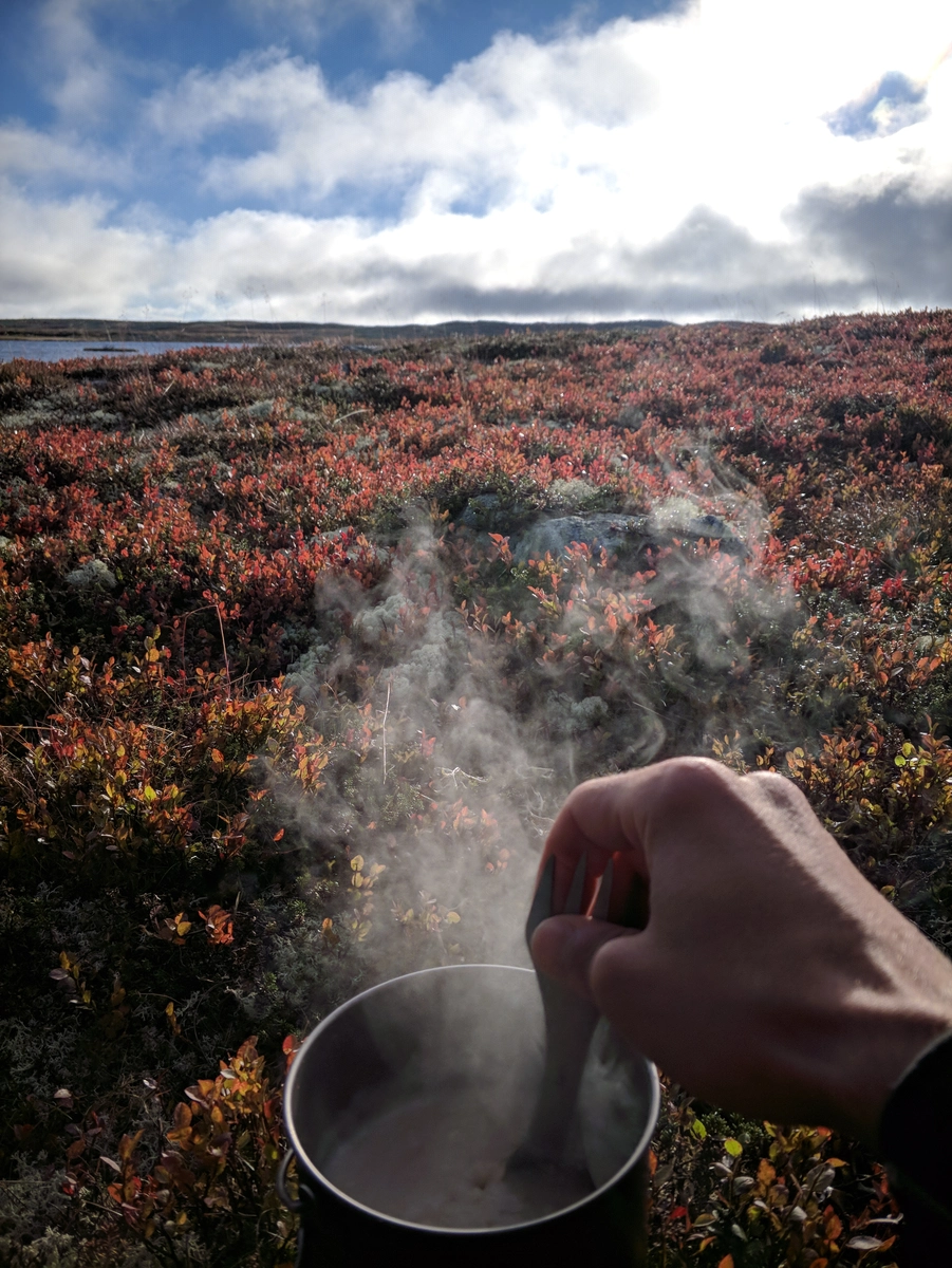
Woke up later than usual and made breakfast while the wind calmed down a bit, sitting in the tent door, overlooking a lake and cupping my hands around the steaming titanium pot. Felt pretty cool.
The "metasack" technique paid off, as I was able to pack everything up pretty fast, planning to move all the wet stuff into the shared cabin so it gets a chance to dry up.
In the cabin, encountered a nice Danish couple, including a viking who had already got the fire going and was happy to share some drying surfaces around it. He was carrying the splitting stub using the ax as a handle with one hand, damn!
Went for a no-backpack round to see the Altarringen to the West and Andrew got his entire right foot under water while crossing a rivulet. Sooooo funny, but he didn't think so.
Around the time we got back it was already past 11, so we decided to have lunch in the cabin to give our stuff more time to dry up.
Three giggling ladies showed up as well and chatting them I found out that the proper way to Tjikko required us to return all the way to the stugas instead and then find a trail up the Northern mountain. Of course, this re-planted the seedling idea of wanting to find that tree.
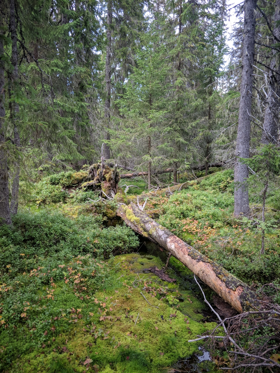
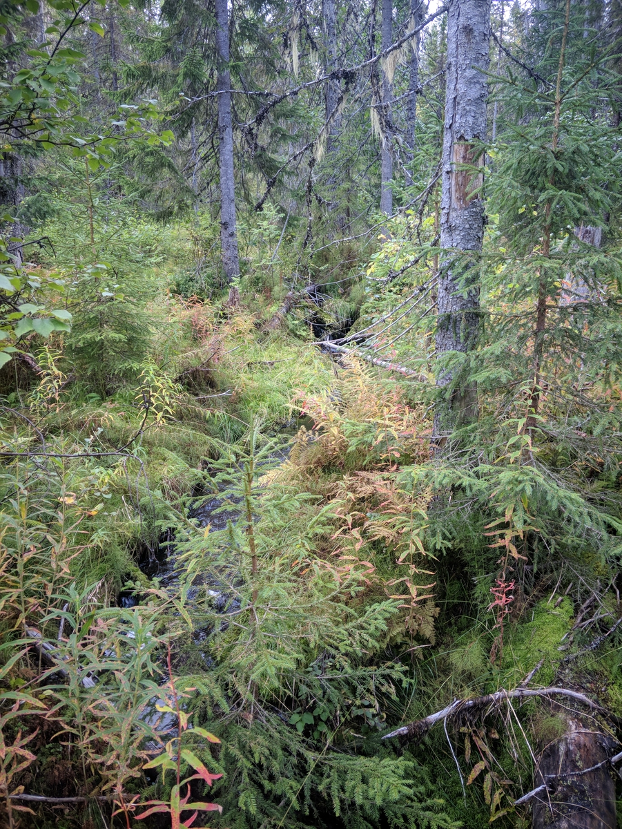
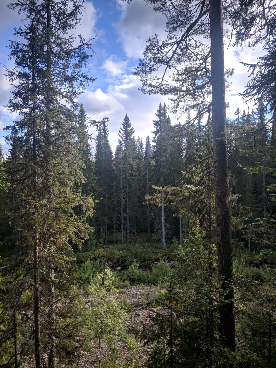
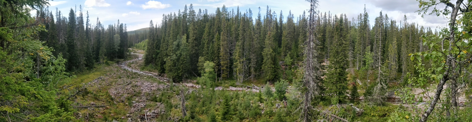
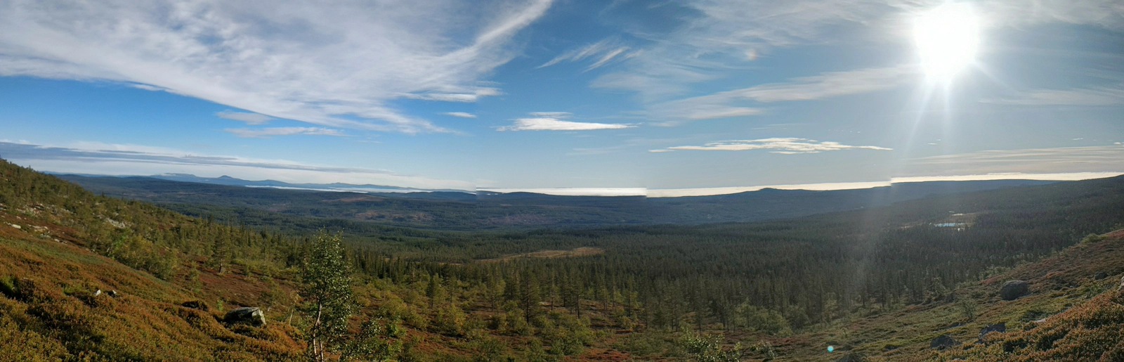
Once everything was nice and dry we packed up and set out to reach the Göljan river valley, a mostly descending trail which brought us back below the tree line. The resulting vegetation provided both wind cover and entertainment.
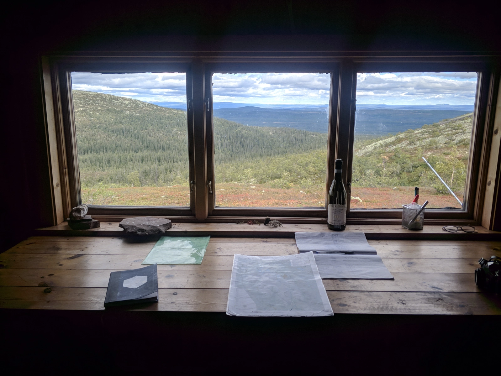
Before reaching the valley we stopped for a breather at the Goljåstugan - very nice views from the cabin, along with a wine bottle candle. Decided to not steal the emergency mashed potato ration from the cabin cupboard, which in retrospect might have been a bad idea.
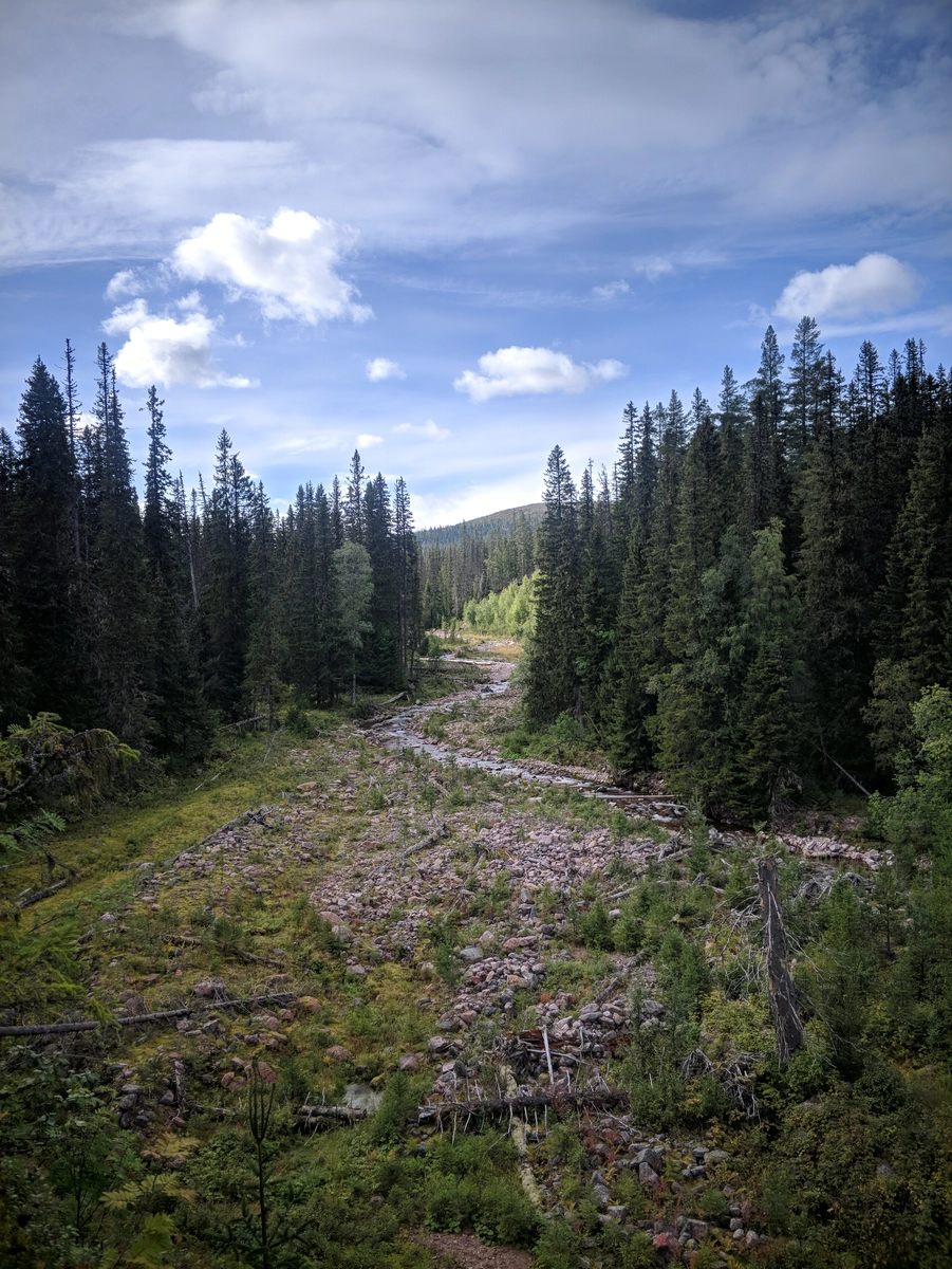
It would appear this valley was subjected to the region's most severe thunderstorm in 1997, with more than 700 recorded thunder strikes. It rained so much that giant boulders were dislodged from the mountains:
"The Göljån River swelled to 500 times(!) its normal volume, and a wall of water up to six metres high swept through the valley. All vegetation was swept away - even the giant spruces along the waterways. Today, the plants are slowly returning."
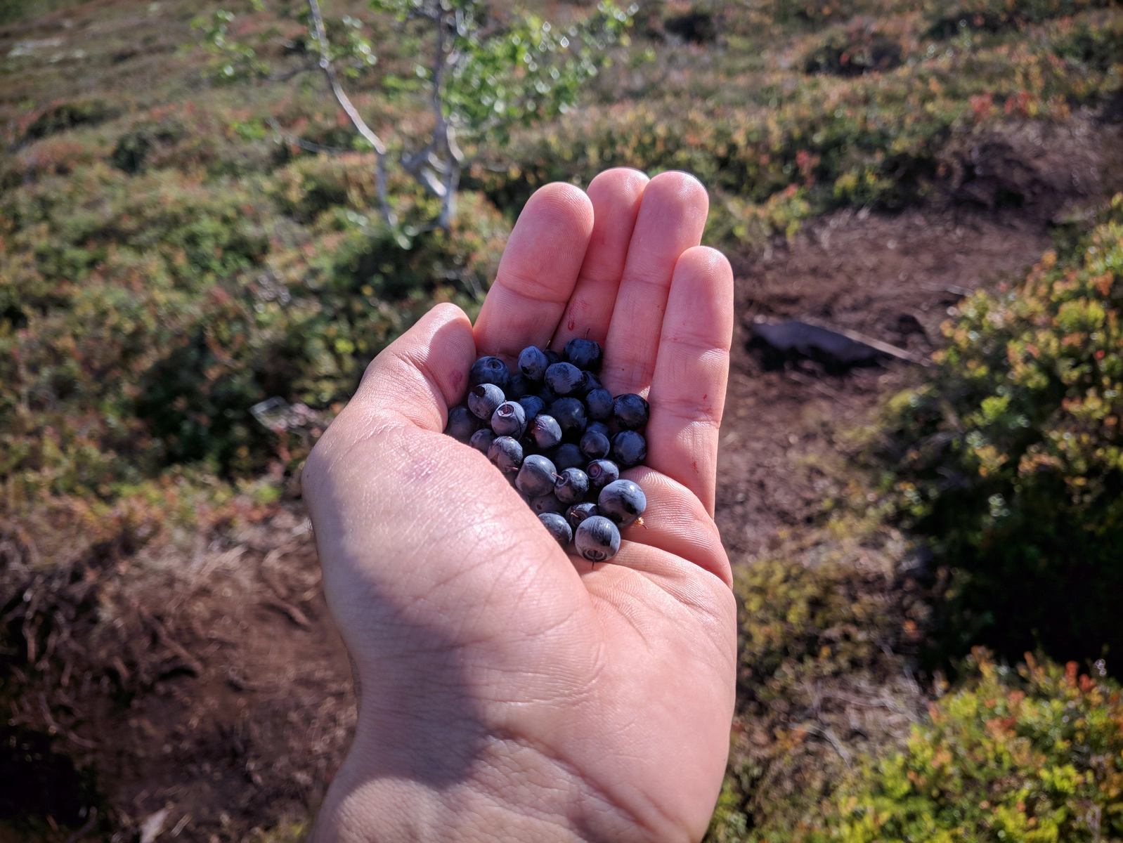
Dark thoughts about missing my main objective (Old Tjikko) still plagued me along the valley and no amount of blueberry gorging would keep them at bay.
Therefore, once we reached one of the last trail forks, I decided to head to the Northern parking, thinking I'd get better views of the river while crossing it, while Andrew continued on to get to the Southern parking. We parted without words, but deep inside I knew we would not meet again until Stockholm, as I was ready to enact a crazy plan of marching all the way to the main entrance on a country road.
What followed was pretty epic:
I made my way across the river over a very rickety bridge, scaled the left bank, stopped for a breather on a bench near a nice observation spot and also used this opportunity to change back into normal pants from the rain combo.
And then started, once having reached the parking started to march North on the car road, planning to at least reach Mörkret and camp somewhere near it for the night
And marched
...and marched...
...and all the while was starting to go down with a bit of food panic, having only enough resources for the next morning, but then also somewhat at ease because these lands were roamed more often by fellow humans.
The strategy I used to push myself forward was to march for 30 minutes, then take a 5 minute break, rinse and repeat. This was accompanied by a focusing on a distant tree as a "target" and keeping it in sight until reached. Great way to cover distance, but not super-enjoyable.
At some point I passed a gathering of hunters who were cooking dinner and having a jolly good time
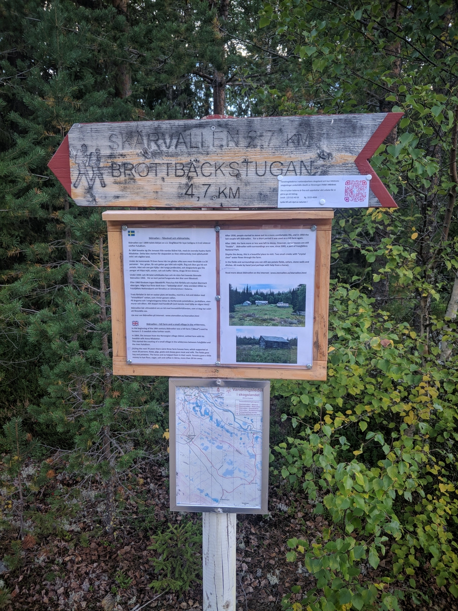
Next, I passed a sign pointing to an abandoned village/farm called Skärvallen, that was built by a single family a century ago. Very tempting to go check out their simple ways of living, but I had to reach an objective, so decided not to stray.
By the time I'd almost reached Mörkret, there were two ways to proceed, both feeding into the paved road that went all the way back to Njuperskär: north and then east, or east and then north.
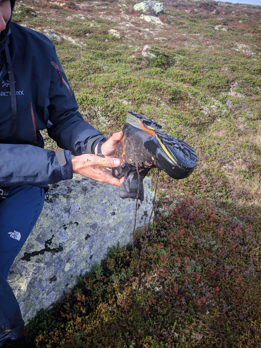
I picked the second and it turned out to be a mistake as it fed into a forestry road that was quite boggy, with lots of tree remains you could trip on, so pretty damn hard to navigate. Also, felt pretty bad about getting my feet damp after 18 km of keeping them dry. The first segment of this route however was pretty decent, and I also found a very nice camping spot by the lake, with running water, fireplace, etc. But I had a mission in mind, so gave up on it to push forward, therefore risking setting up camp in the dark. Hi ho.
The trail connecting to the paved road was very poorly marked so I panicked a bit before finally managing to cross over and find it, along with an indicator saying it's "just" 2.7 more kilometres to the reservation entrance stugas.
As light was failing fast I basically ran the first 1 km uphill on a very steep slope. It's amazing what the body can do when it is driven by primal fears.
In retrospect, I should have probably tried speaking to any car owners along the car road that I marched and offer them some quick cash in return for a 20 minutes drive that would have put me back at the park entrance. Need to fix my socials.
Some of the last sections even required me to turn on the headlamp. The situation was pretty desperate: light failing, no food and no shelter.
But in the end I reached the parking, found out that there's a restaurant + shop, plus a "fika" cabin where it was possible to cook under shelter, but they wouldn't allow sleeping. Still, huge stones off my back knowing I wouldn't starve for the next day, could set out on my mission to find Tjikko and also had backup shelter in case anything went wrong with the tent.
After sacrificing the last traces of light in favor of cooking and consuming the last MRE (I was starved), I ended up pitching the Kuiu in complete darkness using the headlamp. It was more straightforward than I though, and I used the shelter cabin intelligently during the process (i.e. took out only the tent bags when setting up, then returned for the full pack + made sure I was properly clothed as it also got pretty darn cold).
And that's it, it was probably a 40+ km day, but at the end of it I was, once more, in a good position to resume the quest for the oldest tree in the world. Totally worth it.
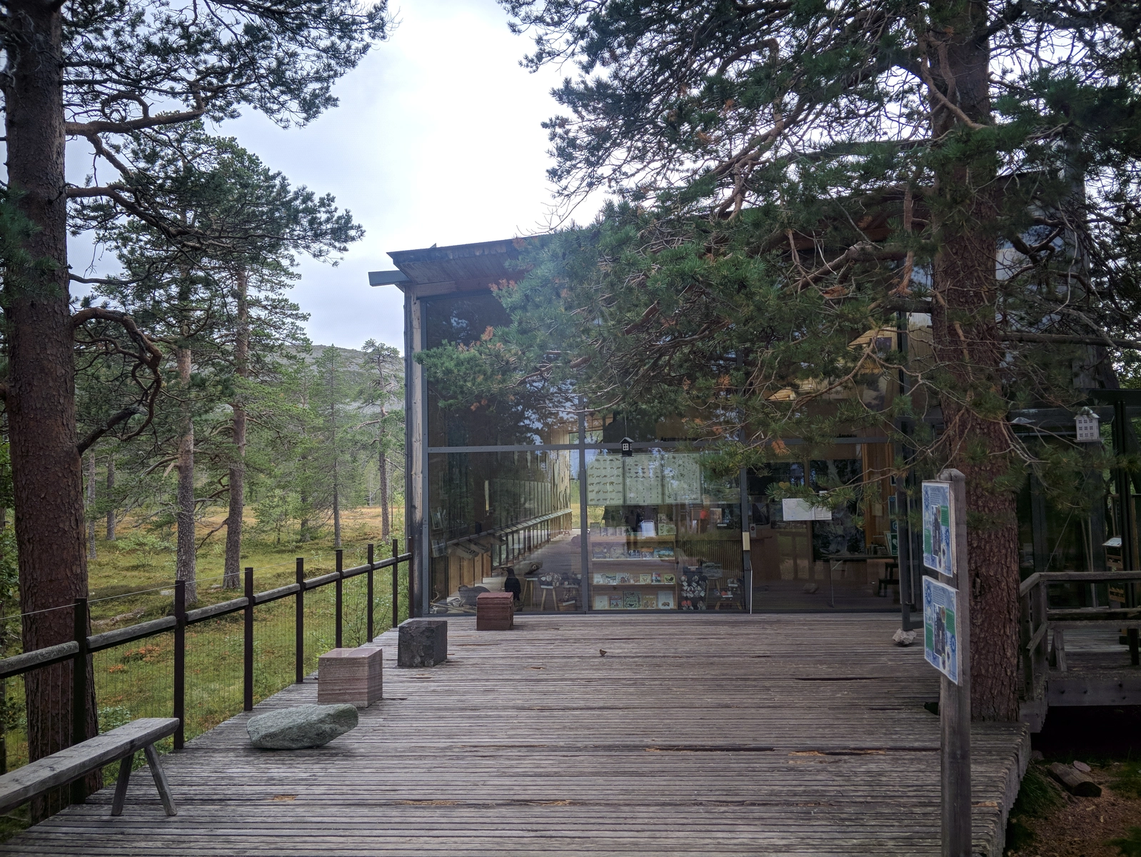
Early (0630-ish) breakfast in the shelter-stuga near Naturum.
Filtered some water from the stream, useless in retrospect as there was potable water in the facility near Naturum (look for the drinkable water sign).
Packed everything up and prepared clothes for day-tripping in the quest to find Tjikko. Perhaps got a bit too much stuff in the backpack with me, but that's alright, as mountain weather is known to be capricious.
At the Njuperskär stugas, took the most unmarked route possible which led me to a ridge parallel to the higher one that we explored on Thursday.
After losing the trail and panicking a bit, found a way to traverse to the higher ridge, and after some stumbling found a very clear trail that was going southeast to northwest (towards the waterfall).
My spider senses told me that taking the unintuitive turn to the right would result in a trail going up the Söthålshön hill, whose next-to-last topographic line should be the one closest to Tjikko.
I was right, and this was a much nicer way to ascend than the bouldery vertical which was marked
However, once on flatland, with no spruce in sight, stumbled upon an X trail intersection and panicked:
Quickly excluded the forward direction as that would lead to the part of the hill already explored on Thursday
Turned left and got to a bank with many shrubs overlooking Njuperskär, but no Tjikko in sight...
Only one option left, so continued forward after returning to the X, thinking this would be "mission failed"
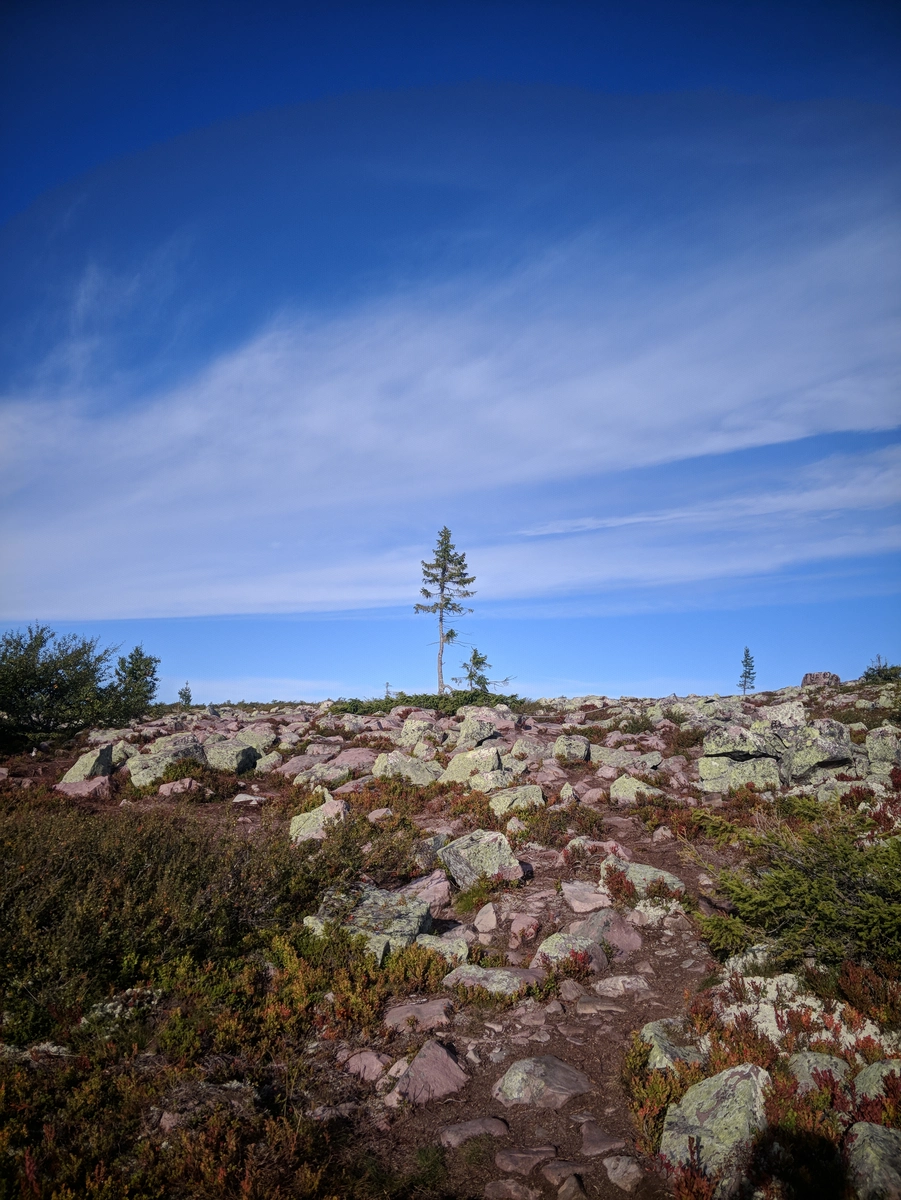
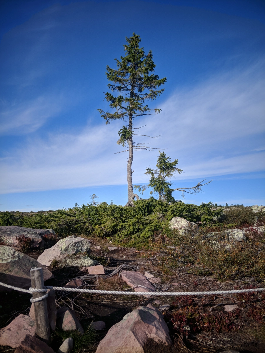
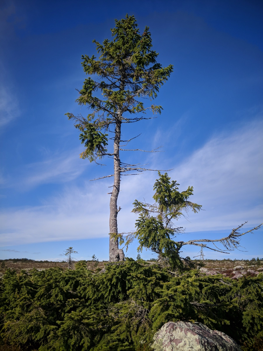
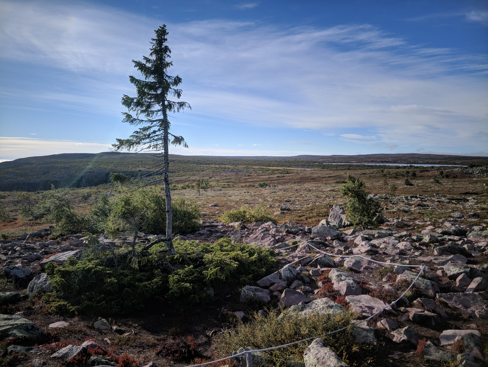
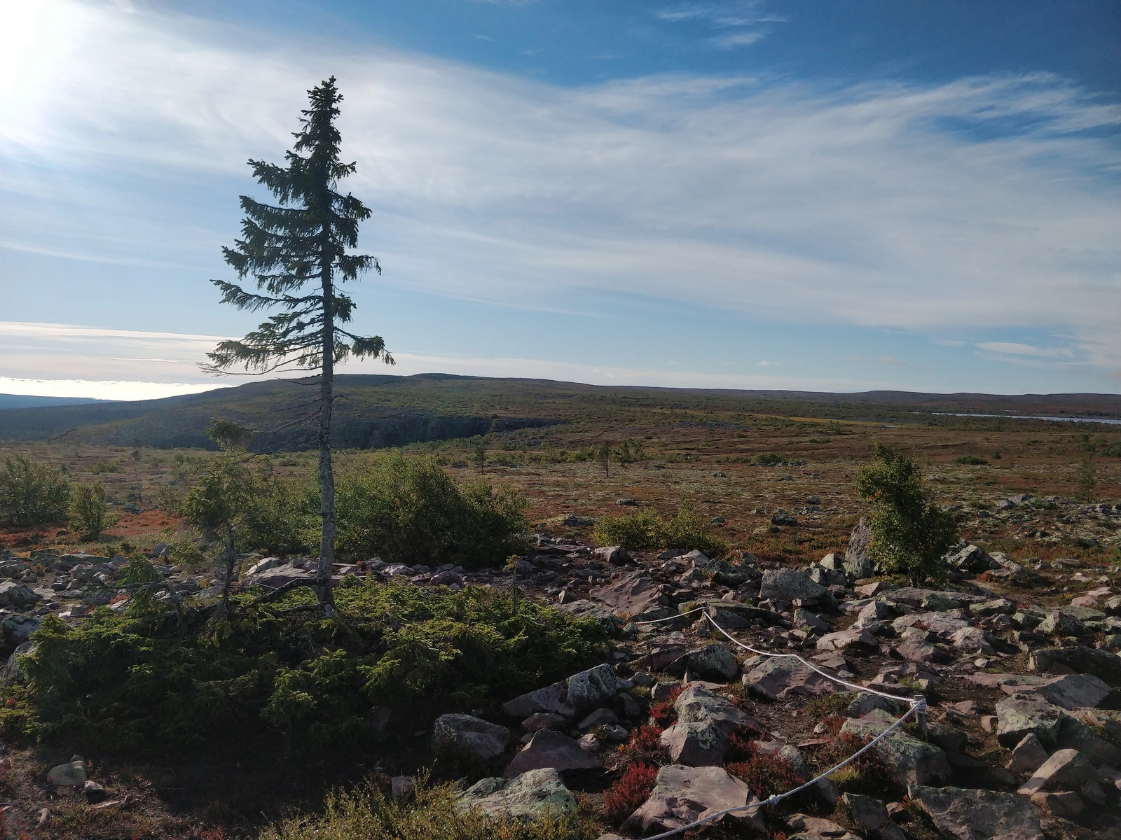
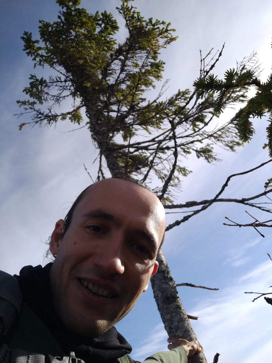
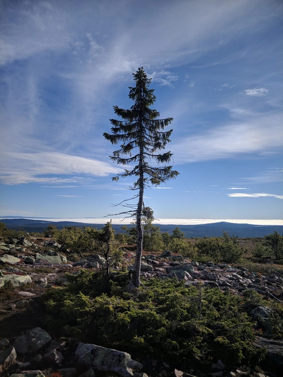
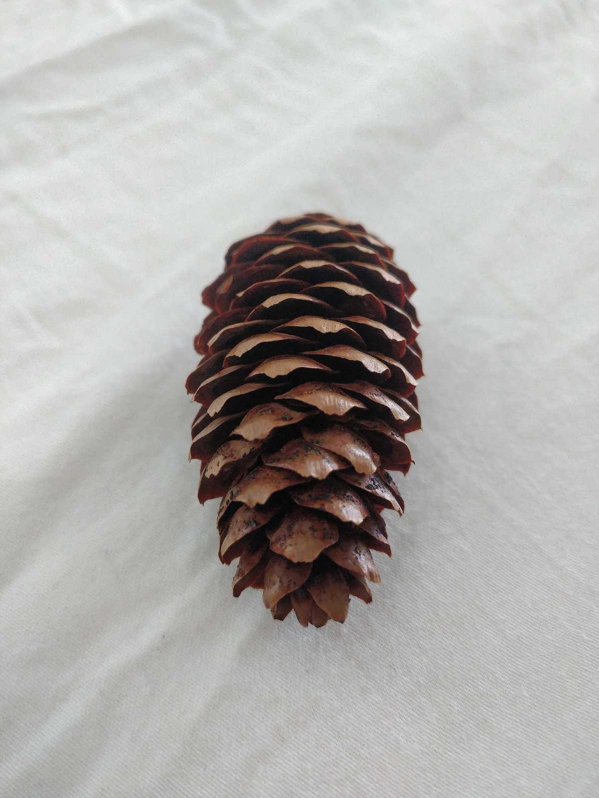
And after 10 minutes saw a weird rope fencing around a feeble-looking spruce in the middle of a large bushy undergrowth: I had found Old Tjikko!!!
The happiness was ineffable, I can still feel it wash over me even as I write these words 1.5 days later.
Felt so immensely grateful for getting a chance to touch this elder being and even collect one of its cones
Took a lot of photos, and had a video call with parents to share this happy moment.
Another couple approached and I waved at them, they took some photos and left.
Descending on the same outwardly ridge, I stopped for some blueberry gorging as they were virtually everywhere
As my trail converged with the Jaktfalsleden, I saw the same couple again, both arriving at the same time, but they had to scramble down rocks and probably also didn't stop for 15 minutes of berry feasting.
Back to camp early, went for some sunbathing + reading + napping.
At 1140-ish went for a delicious schnitzel with blueberry pie for desert and some Twix for appetizer. After yesterday's huge caloric deficit, this was gorgeous.
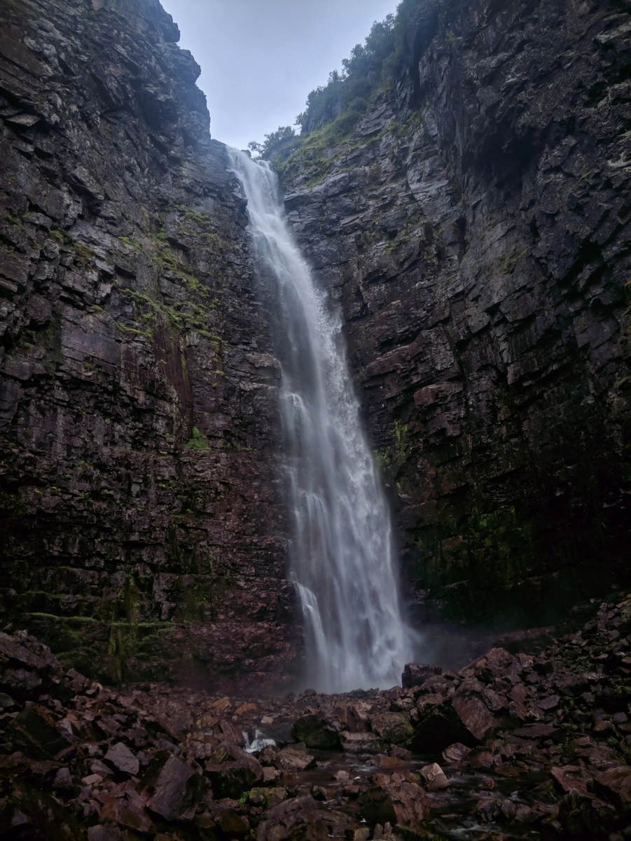
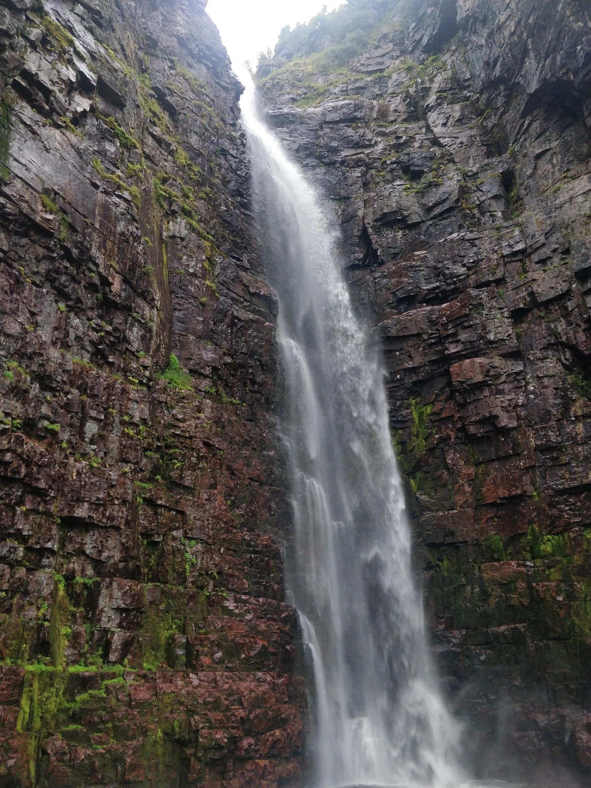
Took another nap, then in full rain gear went for another tour of the waterfall, this time taking the trail leading to its left bank.
It started raining, but did not care - my rain gear is quite invincible.
Managed to do some bouldering and get to a really cool meditation spot to the left of the waterfall, as inspired by a fellow climber. It was there that for the 2nd time in a day I got washed over (both literally and figuratively) by a feeling of absolute gratitude for being alive and getting to experience all this natural beauty our home planet has to offer. Simulation or not, the cascading water patterns along with the falling rain made me feel very at peace with everything.
Remembering an old dude who showed up at the waterfall together with his lady and 2 cool doggos:
Man, he looked funky: leather cap with textile rim and puffball + leather shoes on top of thick woolen socks + some sort of leathery contraption strapped around his neck containing the map. Should've asked him politely if I could take a photo. What is it with me and not talking to people?
Back at the station 1620, fucked around the tent for a bit before heading in for a burger at 1635. The dude in the kitchen was like: "a burger?!?"
Apparently they close at 17 but last order is 1630... But, he still fixed it for me and it was glorious!
Then I was back in the tent reading while the rain picked up, so cooped up nicely there for the rest of the day.